KB2
About KB2
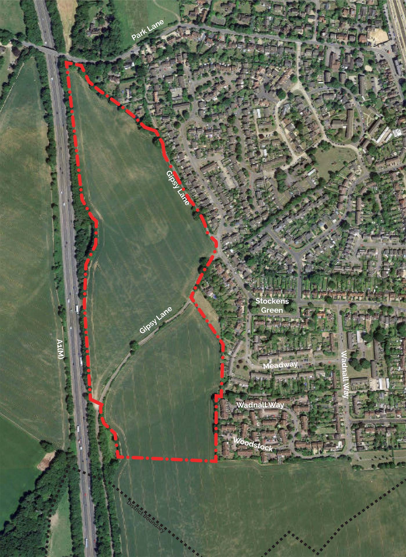
KB2 sits between Knebworth and the A1(M) to the south of Park Lane. The site is made up of open arable land with the southern end of Gipsy Lane crossing the site diagonally about two-thirds of the way down the site.
This splits the site into two fields with the northern field being approximately twice as large as the southern one. To the north, the site tapers to a point with a narrow frontage onto Park Lane. The southern boundary of the site is defined by the extent of the Green Belt which runs in a straight-line west from the edge of the existing village.
KB2 has a rolling topography that results in diagonal valleys running across the site. The green ribbons that run up the east and west sides of the site, setting up a distinctive rhythm of parcels.
KB2 has little in the way of trees, but some small patches of hedgerow along Gipsy Lane and crossing the site from east to west alongside the road and will be enhanced. Where new green links will provide further opportunities for new wildlife corridors.
Existing houses back onto the site, so that the eastern edge is largely green with trees and hedgerows which form the boundaries to rear gardens apart from a strip to the north of KB2 where Gipsy Lane separates the properties on Orchard Way from the site.
Objectives
Key strategic objectives for KB2
KB2
Key aspects of the development on KB2
Housing
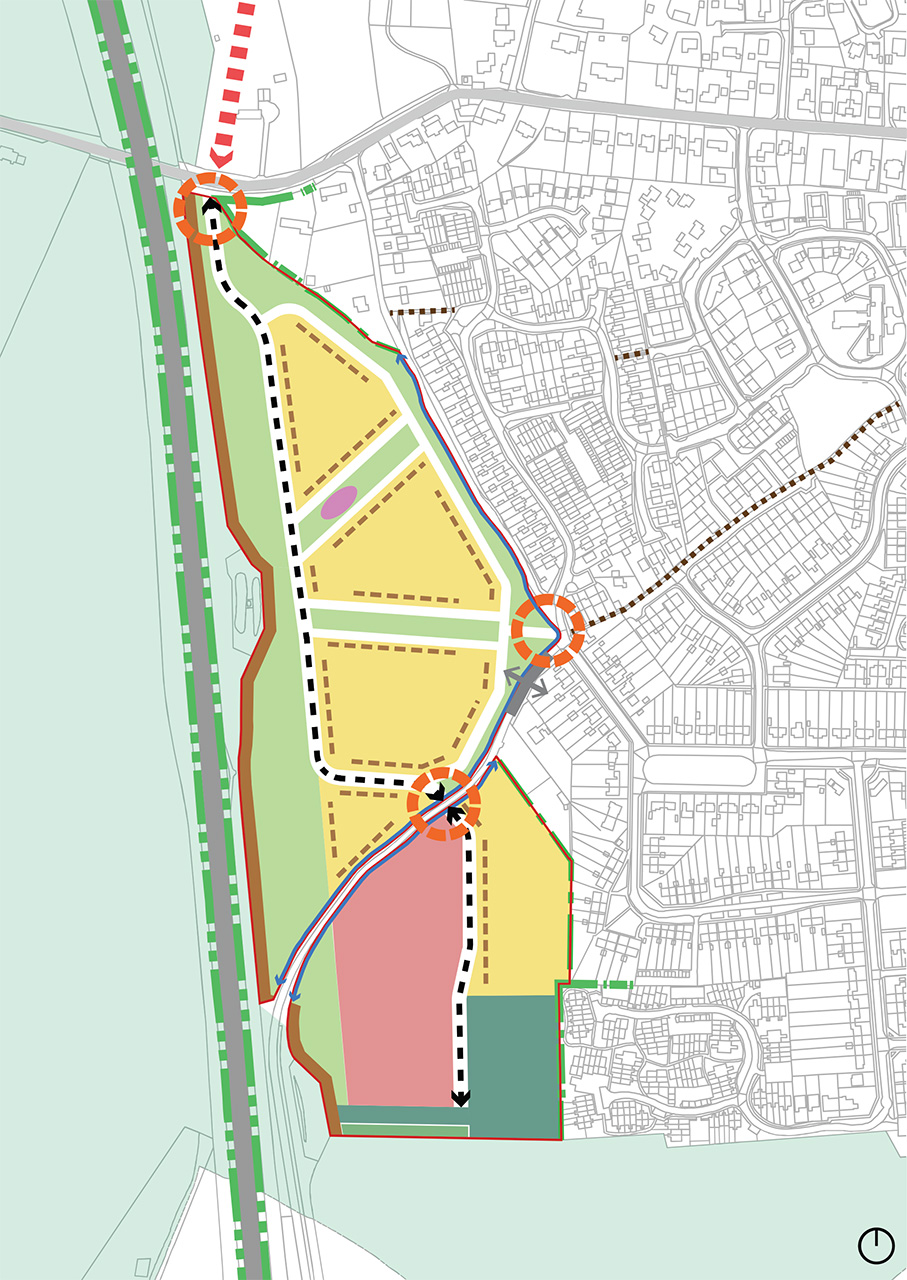
KB2 is designated for circa 184 homes of which will be a variety of size and tenure allowing for maximum opportunity for those wishing to downsize, move to a bigger family home or first-time buyers.
Open space
The valley features through KB2 offer the chance to combine surface water drainage requirements with linked open spaces creating rich biodiversity.
KB2
KB2 and the Primary School
A key feature of the proposals on KB2 is the provision of land for the Primary School which is a significant benefit for the local community promoting access to the new primary school to the west of the village.
Land for a new Primary School
Significant engagement has been undertaken with Hertfordshire County Council, as the education authority, to inform the location of the school site within the KB2 allocation and this indicative location has been shown on the Strategic Masterplan.
The school site will form part of an application for KB2, where following consent, the land would be transferred to Hertfordshire County Council as the education authority. It will then be for the County to submit a Reserved Matters application providing the details for how the school site will be developed for the new school.
The position of the school provides good connections into the rest of the village with active routes directly into the centre of the neighbourhood. The location also creates the opportunity to situate the school at a key point on the foot/cycle network in KB2, and create a focal destination point at its entrance, coinciding with a key view over the KB2 site from Stockens Green Conservation Area.
Review of school site location options